
EPA's BASINS 3.0 and
the TMDL for Lake Austin
CE394K.2 Surface Water Hydrology
Project Proposal
Kristina Schneider
Bridge for 360 over Lake Austin
![]()
EPA's BASINS 3.0 program is currently out in Beta release. It is the newest update to BASINS 2.0 and should be released in the spring . The BASINS programs are designed to investigate water quality conditions in water bodies and in itself is not a model. BASINS provides an interface that allows the user to interact with point and nonpoint source pollution models in GIS based environment. BASINS stands for Better Assessment Science Integrating Point and Nonpoint Sources and was developed to aid in the determination of TMDLs (Total Maximum Daily Loads). The program ArcView is utilized to upload GIS data from the BASINS database, which is provided by EPA’s Office of Science and Technology. The three models available with BASINS 3.0 are SWAT, QUAL2E, and NPSM (HSPF). The database provides the data input for all the models, which include base cartographic data, environmental background data, environmental monitoring data, and point sources/loading data.
I would like to investigate BASINS 3.0 ability to model the hydraulic and water quality conditions of Lake Austin. Lake Austin is located below Tom Miller Dam and is part of the Lower Colorado River Basin (See the map below).

Lake Austin is listed under the Clean Water Act's 303(d), in which states indicate waters that do not meet the states water quality standards and are awaiting the determination of a TMDL. TMDL stands for Total Maximum Daily Load of a pollutant that maybe allowed into a water body. The sources of TMDLs are often non-point source pollutants, which are hard to characterize. I hope to demonstrate BASINS 3.0 effectiveness in helping to determine TMDLS. This problem involves the hydrology of the Lake Austin watershed as basis for the determination of optimum water quality levels.
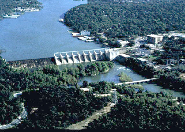
Tom Miller Dam