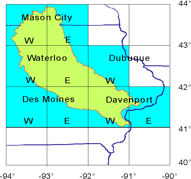
Figure 5.3 1° quadrangles of DEM utilized to subdivide the Iowa-Cedar River basin into modeling units; Map projection: geographic.